GP International
Wildfire dashboard
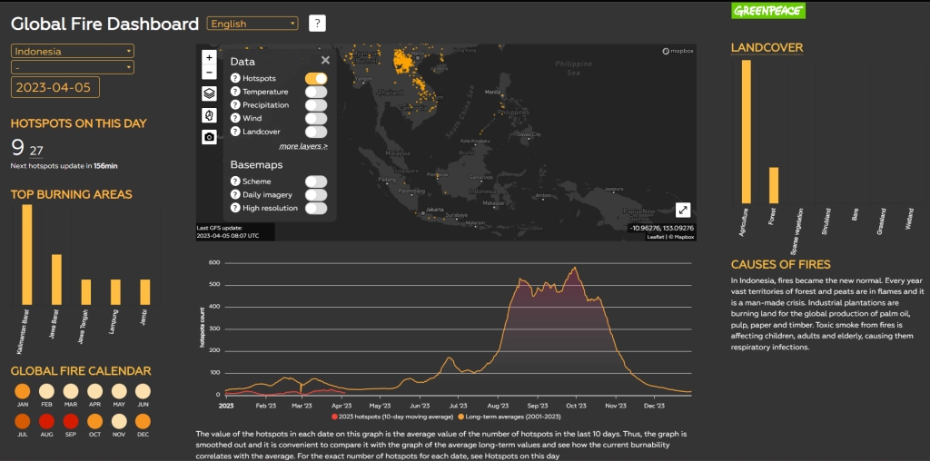
This tool can help predict the catastrophe, prepare a public campaign on fires and follow the development of the situation using maps and satellites.
As wildfires are raging globally, this global operational tool provides data for planning and reactive activities. You can predict the catastrophe based on long-term statistics, follow the development via satellite imagery and hotpot data in near real time and make forecasts taking into consideration weather conditions and landcover.
The Dashboard allows you to get an overview of the current situation, track smoke distribution, compare hotspot dynamics with the average annual values and make prognosis.